

3D software for factory layout & plant design
Powerful Professional CAD software for your projects
Free 2D/3D CAD Software
P&ID Software for Intelligent Piping Schematics
Automatic Piping Isometrics for Fabrication and Installation
3D/2D viewer for CAD models and drawings
We develop individually tailored VR solutions
Virtual online meetings
Virtual Reality Viewer for 3D CAD models
Augmented Reality Solutions for Industry
AR-Viewer App for viewing 3D models in augmented reality
Augmented Reality (AR) for your product catalogs
From Parametric Symbols to Automated Drawing Generation
Colour Image Integration into CAD Designs
CAD standardised-part library for even faster design
Creating 3D Models without 3D Knowledge
Rapid generating and processing of 3D sheet-metal components
Software for Intelligent Piping and Process Schematics
Integrated drawing, document and information management
Interfaces and Integrations for ERP, PDM, PLM
We regularly create new tutorial videos
We regularly create new tutorial videos
M4 DRAFTING Package Overview
The software is supplied with an extremely flexible licence management module
M4 DRAFTING Customers in success
Updates, Online Support and Hotline
M4 DRAFTING Package Overview
The software is supplied with an extremely flexible licence management module
M4 DRAFTING Customers in success
Updates, Online Support and Hotline
3D software for factory layout & plant design
Powerful Professional CAD software for your projects
Free 2D/3D CAD Software
P&ID Software for Intelligent Piping Schematics
Automatic Piping Isometrics for Fabrication and Installation
3D/2D viewer for CAD models and drawings
We develop individually tailored VR solutions
Virtual online meetings
Virtual Reality Viewer for 3D CAD models
Augmented Reality Solutions for Industry
AR-Viewer App for viewing 3D models in augmented reality
Augmented Reality (AR) for your product catalogs
From Parametric Symbols to Automated Drawing Generation
Colour Image Integration into CAD Designs
CAD standardised-part library for even faster design
Creating 3D Models without 3D Knowledge
Rapid generating and processing of 3D sheet-metal components
Software for Intelligent Piping and Process Schematics
Integrated drawing, document and information management
Interfaces and Integrations for ERP, PDM, PLM
We regularly create new tutorial videos
We regularly create new tutorial videos
M4 DRAFTING Package Overview
The software is supplied with an extremely flexible licence management module
M4 DRAFTING Customers in success
Updates, Online Support and Hotline
M4 DRAFTING Package Overview
The software is supplied with an extremely flexible licence management module
M4 DRAFTING Customers in success
Updates, Online Support and Hotline
3D software for factory layout & plant design
Powerful Professional CAD software for your projects
Free 2D/3D CAD Software
P&ID Software for Intelligent Piping Schematics
Automatic Piping Isometrics for Fabrication and Installation
3D/2D viewer for CAD models and drawings
We develop individually tailored VR solutions
Virtual online meetings
Virtual Reality Viewer for 3D CAD models
Augmented Reality Solutions for Industry
AR-Viewer App for viewing 3D models in augmented reality
Augmented Reality (AR) for your product catalogs
From Parametric Symbols to Automated Drawing Generation
Colour Image Integration into CAD Designs
CAD standardised-part library for even faster design
Creating 3D Models without 3D Knowledge
Rapid generating and processing of 3D sheet-metal components
Software for Intelligent Piping and Process Schematics
Integrated drawing, document and information management
Interfaces and Integrations for ERP, PDM, PLM
We regularly create new tutorial videos
We regularly create new tutorial videos
M4 DRAFTING Package Overview
The software is supplied with an extremely flexible licence management module
M4 DRAFTING Customers in success
Updates, Online Support and Hotline
M4 DRAFTING Package Overview
The software is supplied with an extremely flexible licence management module
M4 DRAFTING Customers in success
Updates, Online Support and Hotline
3D software for factory layout & plant design
Powerful Professional CAD software for your projects
Free 2D/3D CAD Software
P&ID Software for Intelligent Piping Schematics
Automatic Piping Isometrics for Fabrication and Installation
3D/2D viewer for CAD models and drawings
We develop individually tailored VR solutions
Virtual online meetings
Virtual Reality Viewer for 3D CAD models
Augmented Reality Solutions for Industry
AR-Viewer App for viewing 3D models in augmented reality
Augmented Reality (AR) for your product catalogs
From Parametric Symbols to Automated Drawing Generation
Colour Image Integration into CAD Designs
CAD standardised-part library for even faster design
Creating 3D Models without 3D Knowledge
Rapid generating and processing of 3D sheet-metal components
Software for Intelligent Piping and Process Schematics
Integrated drawing, document and information management
Interfaces and Integrations for ERP, PDM, PLM
We regularly create new tutorial videos
We regularly create new tutorial videos
M4 DRAFTING Package Overview
The software is supplied with an extremely flexible licence management module
M4 DRAFTING Customers in success
Updates, Online Support and Hotline
M4 DRAFTING Package Overview
The software is supplied with an extremely flexible licence management module
M4 DRAFTING Customers in success
Updates, Online Support and Hotline
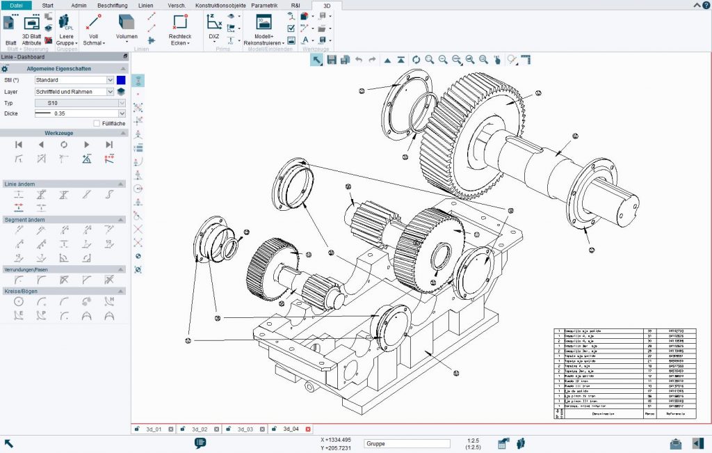
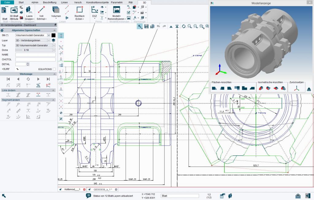
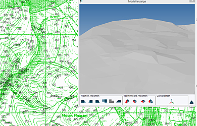
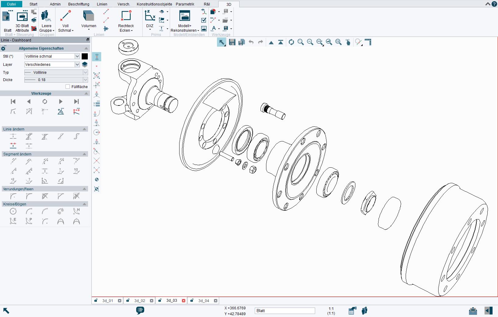
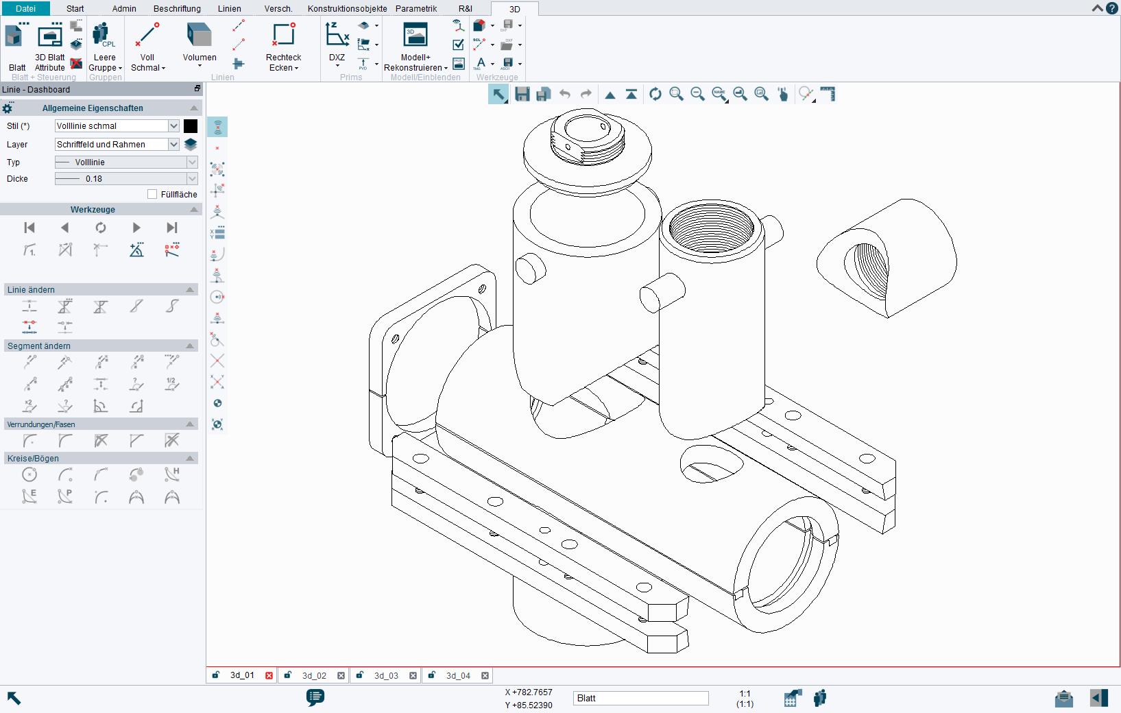
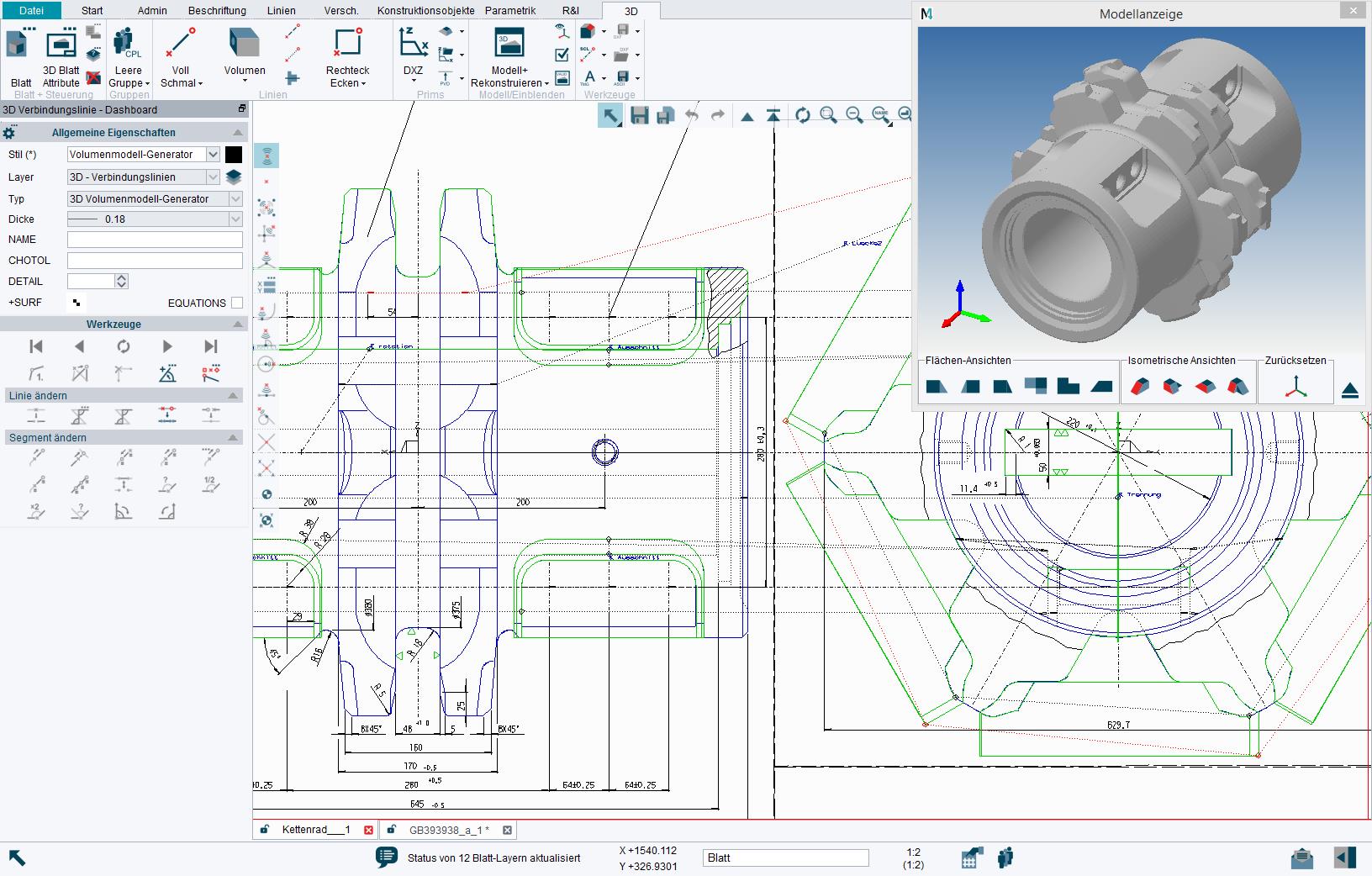
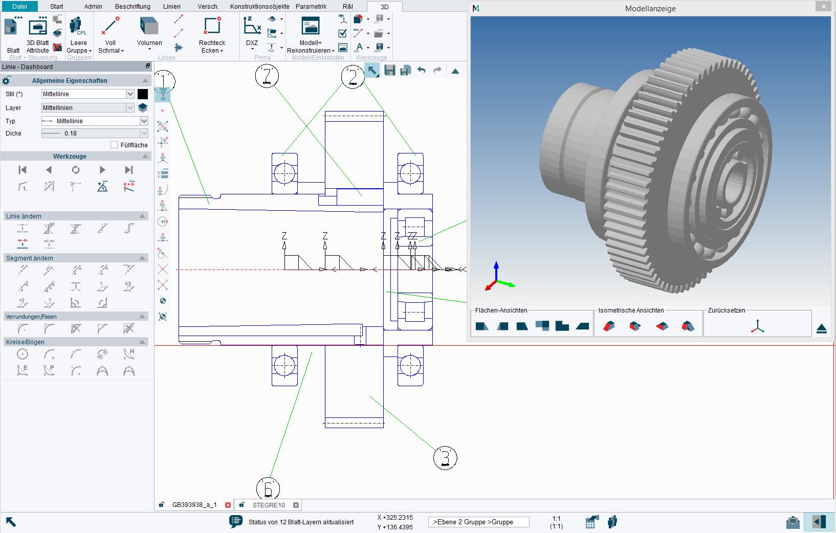
The 3D CAD modelling in M4 DRAFTING convinces by its simple operability. Created for users who also wish to use their 2D expertise with 3D modelling, the add-on M4 DRAFTING module offers an intuitive approach to 3D for the highest level of productivity. 3D models are generated simply in a drawing in this case on the basis of several 2D views. Thus a very fast generation of a model, even without special 3D knowledge, is possible. M4 DRAFTING also allows rapid and simple processing of the 3D models. The integrated 3D viewer enables the interactive inspection of the 3D model on different levels of detail.
The 3D CAD modelling in M4 DRAFTING offers an integral viewer, which allows you to view your models and interact with them by zooming, panning and rotating them in a dynamic colour-shaded environment.
Don't miss M4 DRAFTING!
Try our 2D/3D CAD software now for free